Original 1914 WWI Times War Atlas NORTH SEA MAP German Airship Sheds Forts Docks For Sale


When you click on links to various merchants on this site and make a purchase, this can result in this site earning a commission. Affiliate programs and affiliations include, but are not limited to, the eBay Partner Network.

Original 1914 WWI Times War Atlas NORTH SEA MAP German Airship Sheds Forts Docks:
$24.99
Originallarge-format 1914 map published in London by The Times:"Map of the North Sea." - The image area measures 56.5x 42 cm [22¼" x 16½"].
- The coverage area extends from Liverpool, England toHanover, Germany,including London, Paris, Amsterdam, Brussels, Cologne, Frankfurt, Stuttgart, theSkagerrack, and the Kaiser Wilhelm Canal.
- The legend key identifies large docks (dreadnoughts),small docks, German airship sheds, German naval fortresses, submarinetelegraph lines, and international boundaries.
- Condition: This map is in very goodcondition, bright and clean, withno marks, rips, or tears. It has a horizontalcenter fold, as issued,and it is blank on the back, with no printing on the reverse side.Please see the scansand feel free to ask any questions.
- It was one of ten mapspublished in The Times War Atlas, London,1914-1915. It had been disboundfrom the atlas many years ago, and tiny pinholes in the upper cornerssuggest that someone had hung it on a wall during the First World War.
- Buy with confidence! We are always happy to combineshipping on thepurchase of multiple items — just make sure to pay for everythingat one time, not individually.
Powered by SixBit's eCommerce Solution
|
Other Related Items:
Related Items:
Original British Pattern 1914(P-14) Enfield Rifle Extractor-Win, Rem, & ERA $14.50
Original 1914 DR. MILES' WEATHER ALMANAC; 32pgs $29.16
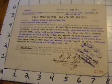
Original 1914 WINOOSKI, VERMONT savings bank debt paper $39.50
creativenoise.net
| 


