When you click on links to various merchants on this site and make a purchase, this can result in this site earning a commission. Affiliate programs and affiliations include, but are not limited to, the eBay Partner Network.
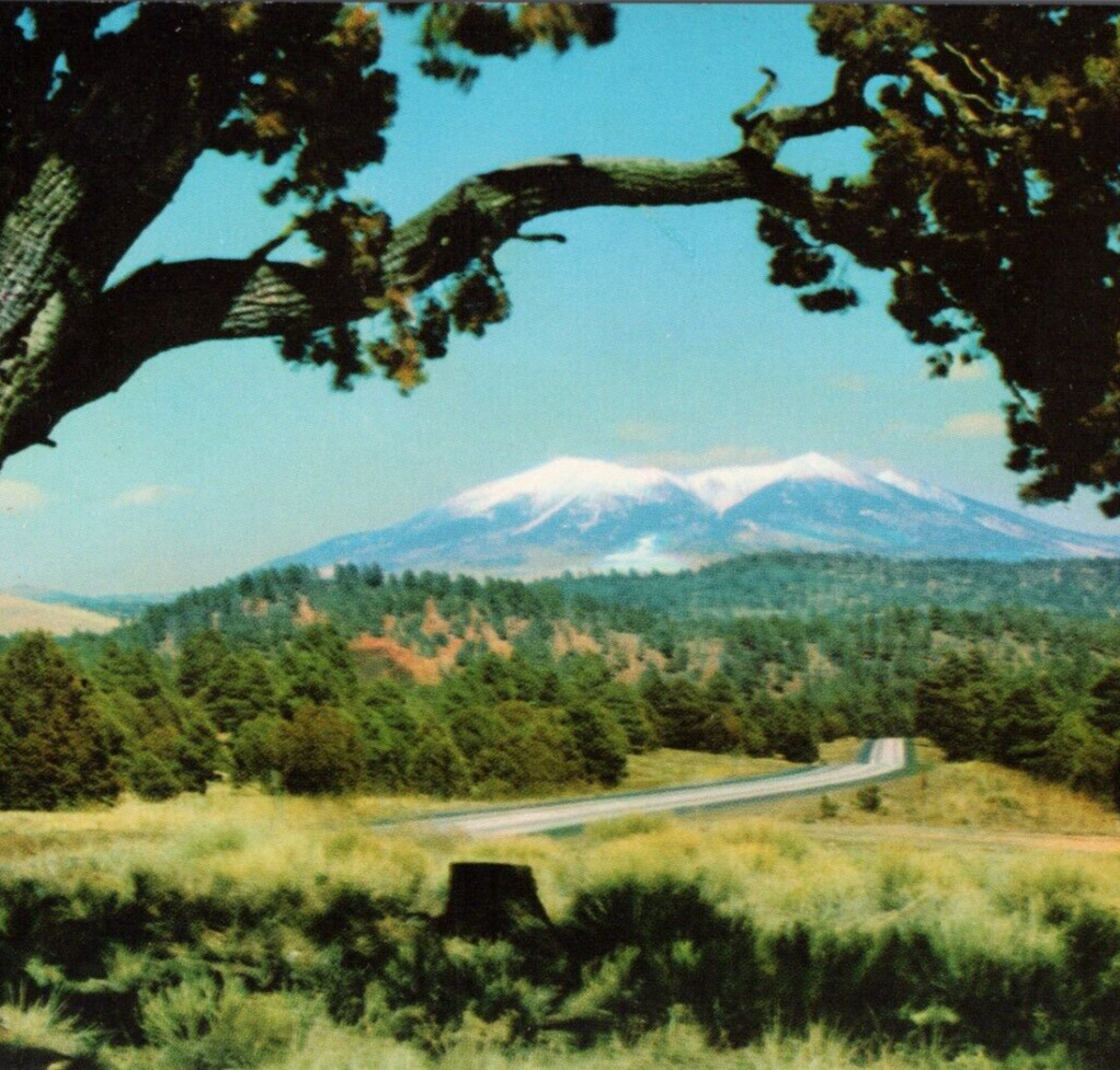
RMF-9 Interstate Highway 40 crossing Arizona.
The mountains framed by this giant alligator-juniper are the San Francisco Peaks as seen between Flagstaff and Williams, Arizona. They are 12,611 feet high, the highest in the BY MIRRO-KROME CARD BY H.S. CROCKER CO., INC., SAN FRANCISCO 1, CALIFORNIA
PUBLISHED BY R. FRONSKE, FLAGSTAFF, ARIZONA
The San Francisco Peaks (Navajo: Dookʼoʼoosłííd, Spanish: Sierra de San Francisco, Hopi: Nuva\'tukya\'ovi, Western Apache: Dził Tso, Keres: Tsii Bina, Southern Paiute: Nuvaxatuh, Havasupai-Hualapai: Hvehasahpatch/Huassapatch/Wik\'hanbaja, Yavapai: Wi:mun Kwa, Zuni: Sunha K\'hbchu Yalanne, Mojave: \'Amat \'Iikwe Nyava) are a volcanic mountain range in the San Francisco volcanic field in north central Arizona, just north of Flagstaff and a remnant of the former San Francisco Mountain. The highest summit in the range, Humphreys Peak, is the highest point in the state of Arizona at 12,633 feet (3,851 m) in elevation. The San Francisco Peaks are the remains of an eroded stratovolcano. An aquifer within the caldera supplies much of Flagstaff\'s water while the mountain itself is in the Coconino National Forest, a popular recreation site. The Arizona Snowbowl ski area is on the western slopes of Humphreys Peak, and has been the subject of major controversy involving several tribes and environmental six highest individual peaks in Arizona are contained in the range:
Humphreys Peak, 12,637 feet (3,852 m)
Agassiz Peak, 12,356 feet (3,766 m)
Fremont Peak, 11,969 feet (3,648 m)
Aubineau Peak, 11,838 feet (3,608 m)
Rees Peak, 11,474 feet (3,497 m)
Doyle Peak, 11,460 feet (3,493 m)
The mountain provides a number of recreational opportunities, including wintertime snow skiing and hiking the rest of the year. Hart Prairie is a popular hiking area and Nature Conservancy preserve located below the mountain\'s ski resort, Arizona Snowbowl.
Humphreys Peak (latitude 35°20\'47\" N) and Agassiz Peak (latitude 35°19\'33\" N) are the two farthest south-lying mountain peaks in the contiguous United States that rise to a height of more than 12,000 feet (3,700 m) above sea level.
Prior to its collapse due to a landslide and hypothesized Mount St. Helens-like lateral eruption to the northeast (around 200,000 years ago) and subsequent glacial erosion, the San Francisco Peaks fully matured elevation is estimated to have been around 16,000 feet (4,900 m).
Interstate 40 (I-40) is an east–west Interstate Highway that has a 359.11-mile (577.93 km) section in the US state of Arizona, connecting sections in California and New Mexico. The Interstate is also referred to as the Purple Heart Trail to honor those wounded in combat who have received the Purple Heart.[2] It enters Arizona from the west at a crossing of the Colorado River southwest of Kingman. It travels eastward across the northern portion of the state, connecting the cities of Kingman, Ash Fork, Williams, Flagstaff, Winslow, and Holbrook. I-40 continues into New Mexico, heading to Albuquerque. The highway has major junctions with U.S. Route 93 (US 93; the main highway connecting Phoenix and Las Vegas, Nevada) in Kingman and again approximately 22 miles (35 km) to the east and I-17 (the freeway linking Phoenix to northern Arizona) in Flagstaff.
For the majority of its routing through Arizona, I-40 follows the historic alignment of US 66. The lone exception is a stretch between Kingman and Ash Fork where US 66 took a more northerly, less direct route that is now State Route 66 (SR 66). Construction of I-40 was ongoing in the 1960s and 1970s and reached completion in 1984. With the completion of I-40 in 1984, the entire routing of US 66 had been bypassed by Interstate Highways which led to its decertification a year later in 1985.
This vintage postcard features a stunning view of I-40 between Flagstaff and Williams, Arizona, showcasing the beautiful San Francisco Peaks. The postcard is a single unit, with a standard size of 5.5 x 3.5 inches, and is printed on high-quality cardboard and paper materials.
The postcard is a photochrome from the era of 1939-now, and is distributed by Southwest Post Card Co. of Albuquerque, New Mexico. It is a great addition to any collection of topographical postcards, postcards, or collectibles. The postcard features a divided back and chrome accents, and is unposted. Don\'t miss out on this amazing piece of art that captures the essence of tourism, travel, and landscapes in Arizona.
Interstate 40
Purple Heart TrailWikimedia| ©OpenStreetMapI-40 highlighted in redRoute informationMaintained routeMajor junctionsWestendI-40atCaliforniastate line
- Future I-11/US93inKingman
- I-17inFlagstaff
- Interstate Highway System
- Main
- Auxiliary
- Suffixed
- Business
- Future
- Arizona State Highway System
- Interstate
- US
- State
- Proposed


